Tracking mid-week heat, spotty t-storm chances
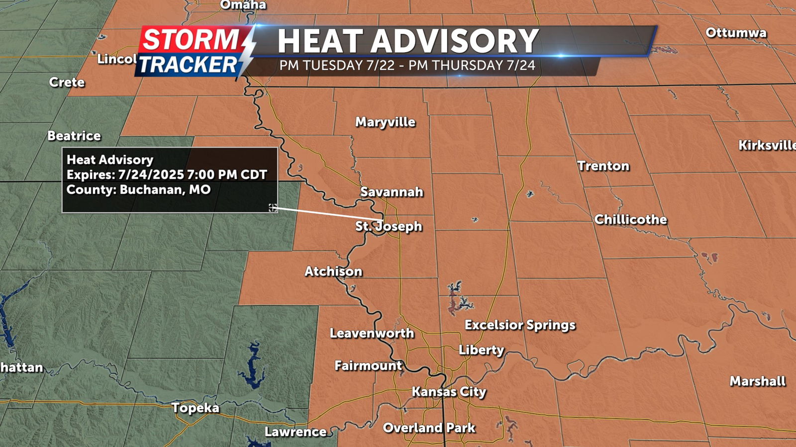
Sunshine, heat, and humidity have returned to Northwest Missouri and Northeast Kansas Tuesday afternoon, and will continue through much of the work week. A Heat Advisory has been issued for all of Northwest Missouri and the eastern fringe of Kansas through Thursday evening. Heat index values of 100+ degrees are forecast for the next several afternoons, increasing the risk for heat related illness.
Between periods of sunshine, a few spotty t-storm chances also remain in the forecast, with the best opportunity for t-storms arriving by Thursday. Most will remain dry Tuesday afternoon and evening, with partly to mostly sunny skies and a 20% to 30% chance of isolated showers and t-storms. Temperatures will cool from the low 90s late Tuesday, into the mid 70s overnight, with light southerly breezes. Sunny, humid, and very hot conditions build across the area Wednesday, with afternoon highs in the low to mid 90s and triple digit heat indices. Periods of cloud cover, and a 40% chance of scattered t-storms returns Thursday. High temperatures Thursday will run in the upper 80s to low 90s, although heat index values will remain high.


