Tracking t-showers Monday, excessive heat returning
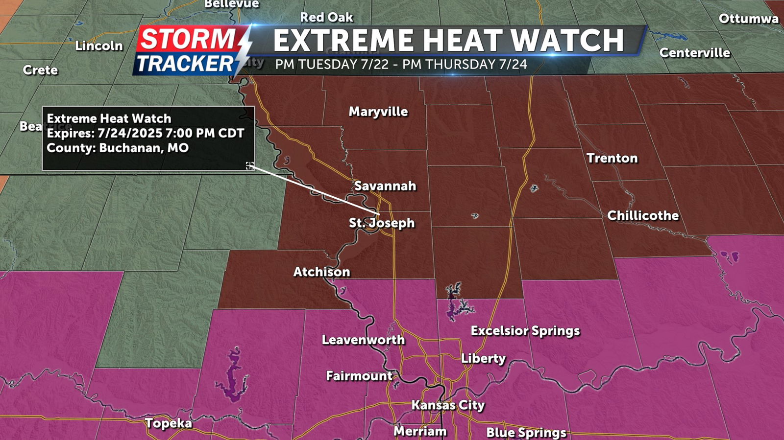
Showers and thunderstorms have delivered a break from excessive heat Monday afternoon and evening across the Mid-Missouri River Valley. A 60% chance of t-showers will continue through sunset, with partly to mostly cloudy skies and temperatures in the 70s. A few storms may produce locally heavy rainfall. A chance of isolated thunderstorms will linger Tuesday morning, before sunshine and heat make a come-back for the afternoon. High temperatures Tuesday will reach the low to mid 90s across the area, with muggy air allowing for triple digit heat index values. An Extreme Heat Watch remains in effect for much of Northwest Missouri and Northeast Kansas, roughly along and north of the highway 36 corridor, from Tuesday afternoon through Thursday evening. Counties along the I-70 corridor, including the Kansas City metro, are under an Extreme Heat Warning for the same time-frame. Afternoon highs will remain in the mid 90s with triple digit heat indices for the next several days, bringing an increased risk for heat related illness. Chances for temporary relief from the heat will return late-week, as opportunities for isolated showers and t-storms return by Thursday.