Tracking spotty showers this evening; severe storm risk increases tomorrow
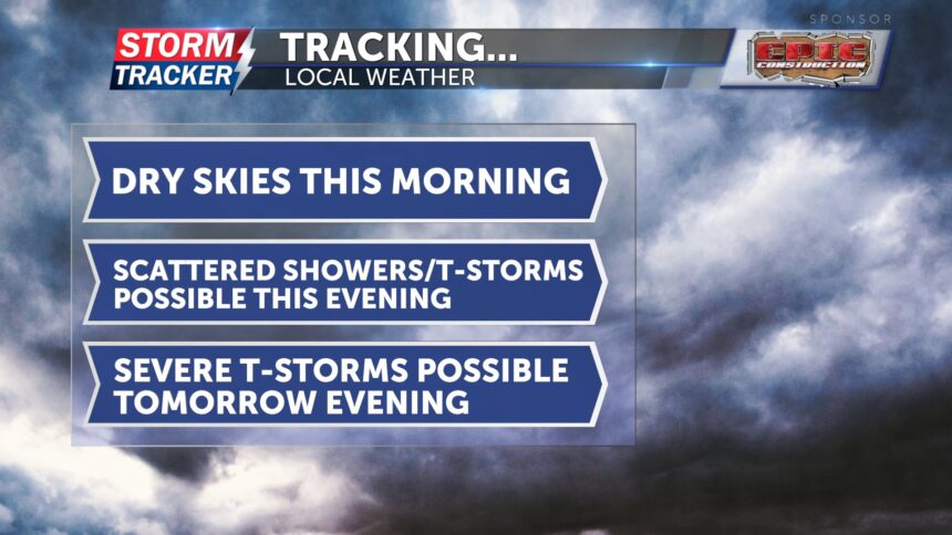
For the rest of your morning, clouds are beginning to break, giving way to more sunshine. It will be a hot and humid day, with highs in the mid-90s. It will feel hotter, as heat index values will be in the upper 90s. Southerly winds will make it a bit breezy, with gusts up to 20 mph. Spotty showers and thunderstorms are possible this evening, but chances remain slim.
Tomorrow, a more organized system is expected to move through along a cold front. Severe thunderstorms are possible, as northwest Missouri and northeast Kansas are currently under a slight risk. The primary threats will be damaging winds and hail, with a low tornado risk. There also could be heavy rainfall in localized areas. Temperatures, heat index values, and winds will be similar to today.
On Saturday, there is a slight chance for showers. Both Saturday and Sunday will be cooler, with highs in the mid-80s. Sunday is trending drier.


