Tracking scattered strong storms late Thursday
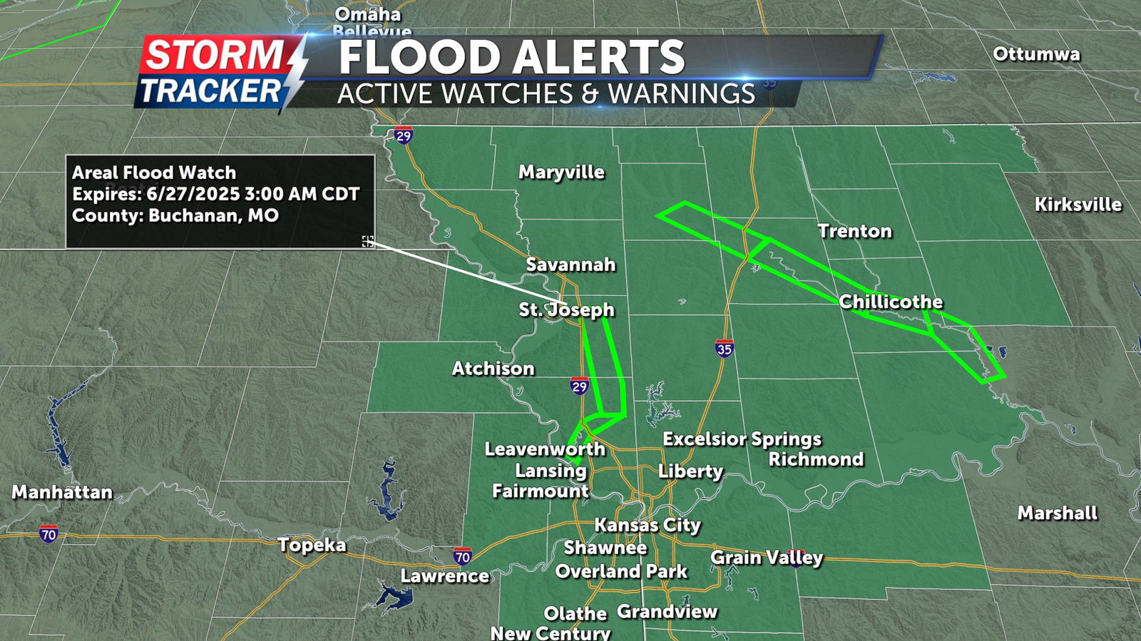
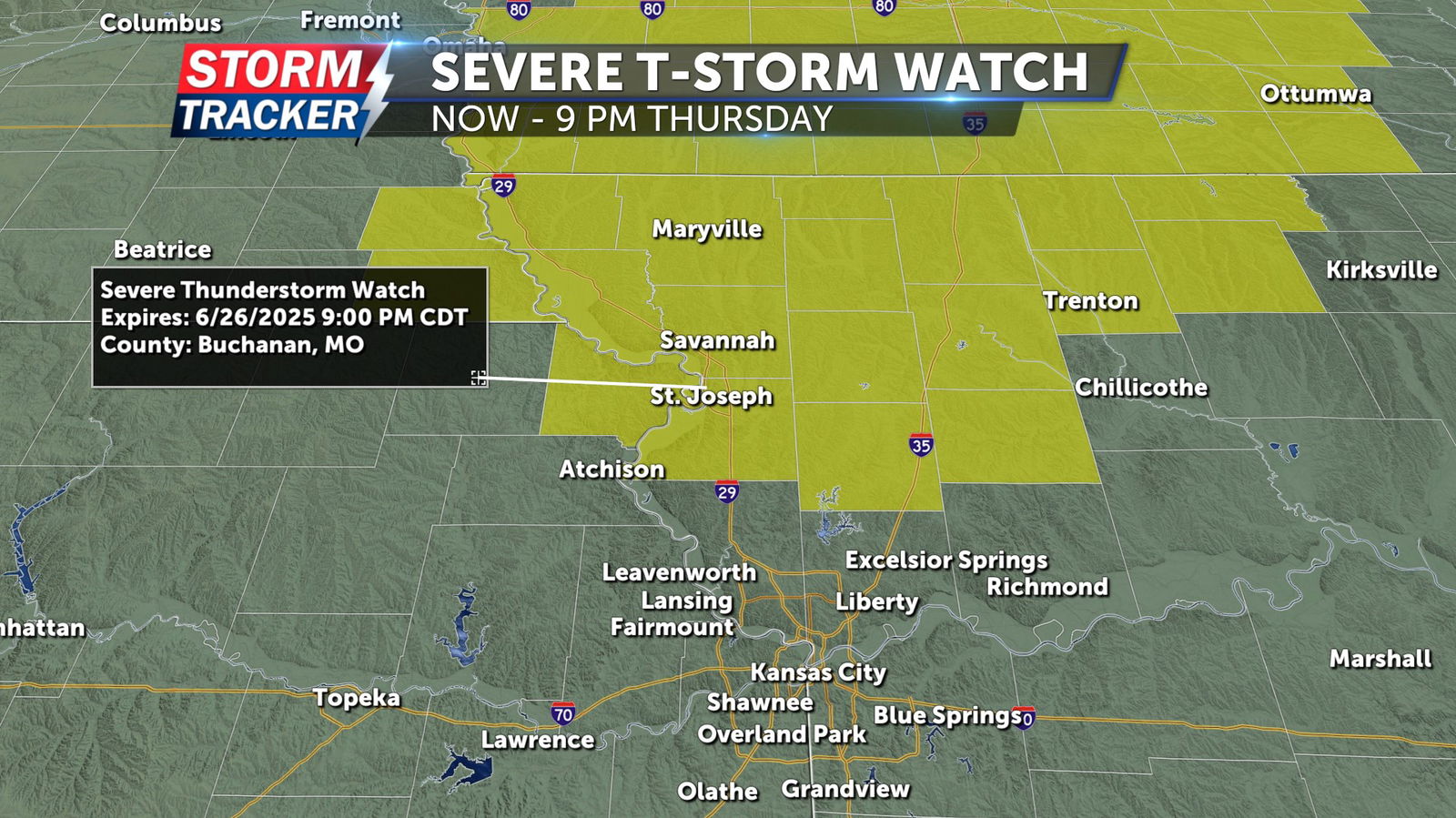
Scattered strong storms will continue to track across the Mid-Missouri river Valley Thursday evening, posing a risk for damaging winds, heavy rain, and flooding. Rainfall of 1 to 3 inches is possible across the region by the time storms exit late tonight, potentially aggravating existing flooding on some area waterways. A 70% chance of t-storms before midnight Thursday will give way to partly cloudy and dry conditions late, with overnight lows in the 70s. Friday will bring afternoon heat and sunshine with a 10% chance of stray t-storms, highs in the low 90s, and heat indices in the mid to upper 90s.
A Severe Thunderstorm Watch has been issued for parts of Northwest Missouri and Northeast Kansas through 9 p.m. Thursday June 26.
A Flood Watch has been issued for parts of Northwest Missouri and Northeast Kansas through 3 a.m. Friday June 27.