Tracking scattered t-storms, lingering heat
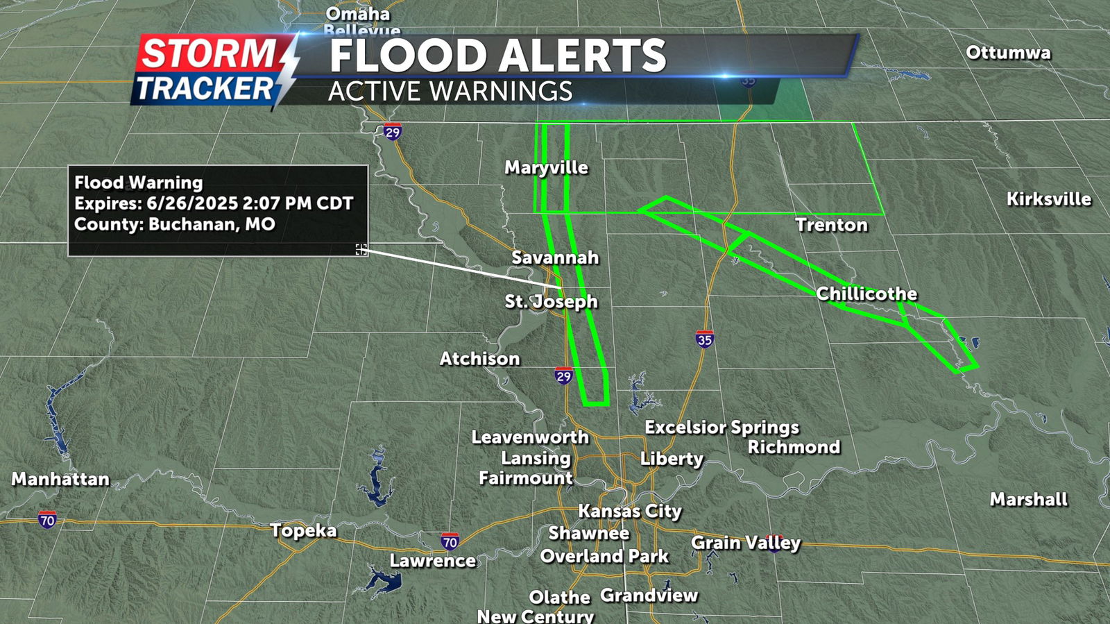
Heavy rainfall across parts of Northwest Missouri has left residual river flooding in a handful of local waterways, especially north of the Highway 36 corridor where 3 to 6 inches of rain has come down since Monday evening. A flood warning remains in effect for the Platte River through Nodaway, Andrew, Buchanan, and Platte county through Thursday afternoon. Scattered thunderstorm chances will continue across the region Tuesday afternoon and evening, before rain chances subside by Wednesday with heat and humidity persisting.
A 40% chance of t-storms continues across the area through Tuesday evening, with partly sunny skies. Temperatures will slowly cool from the low 90s to the mid to upper 70s overnight. Sunshine will prevail Wednesday, with only a 10% chance of stray t-storms for the afternoon and high temperatures in the low to mid 90s. Humid conditions will result in heat index values in the upper 90s to near 100 degrees after lunchtime Wednesday. Scattered t-storm chances will increase Thursday and Friday, with lingering heat and humidity as highs reach the low 90s each day.


