Tracking heat, humidity, and t-storms
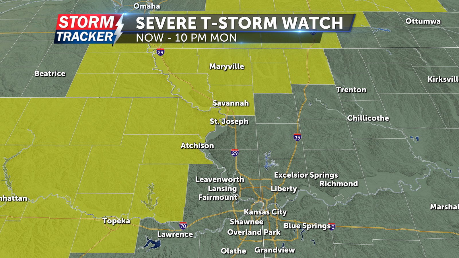
Hot and humid conditions will continue across the Mid-Missouri River Valley Monday afternoon and evening, fueling chances for scattered strong storms across the area into Monday night. A few storms may produce gusty winds, hail, and heavy downpours. A Severe Thunderstorm Watch has been issued for parts of far Northwest Missouri and Northeast Kansas through 10 p.m. Monday.
Monday afternoon and evening will bring partly sunny skies and a 60% chance of t-storms, with temperatures running in the low 90s and southwest winds of 15 to 20 mph. Thunderstorm chances will increase to 70% late Monday night, with lows in the mid to low 70s. Periods of cloud cover and a 60% chance of t-storms will remain through the day Tuesday, with afternoon highs in the upper 80s to low 90s. A few storms may produce locally heavy rainfall, gusty winds, and hail on Tuesday.
Wednesday will bring a break from rain chances, with hot and sunny conditions in the forecast. Above average temperatures will linger through the work week and spotty t-storm chances return to the forecast Thursday and Friday.


