Tracking heavy rain, thunderstorms, and flood risk today
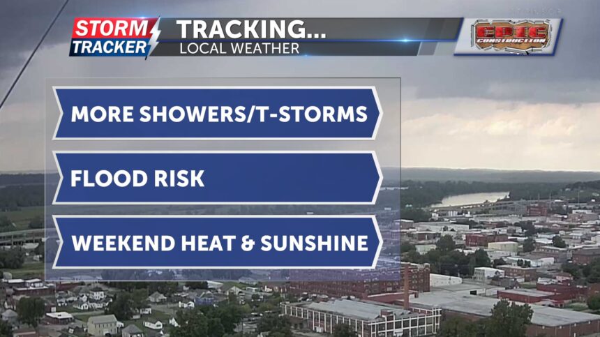
Light showers moved through early this morning, leaving overcast skies across St. Joseph. More showers and thunderstorms are likely today, with a 60 to 70 percent chance, especially during the afternoon and evening hours. Highs will be in the low 80s. A few storms could be strong to severe, capable of producing damaging winds and downbursts.
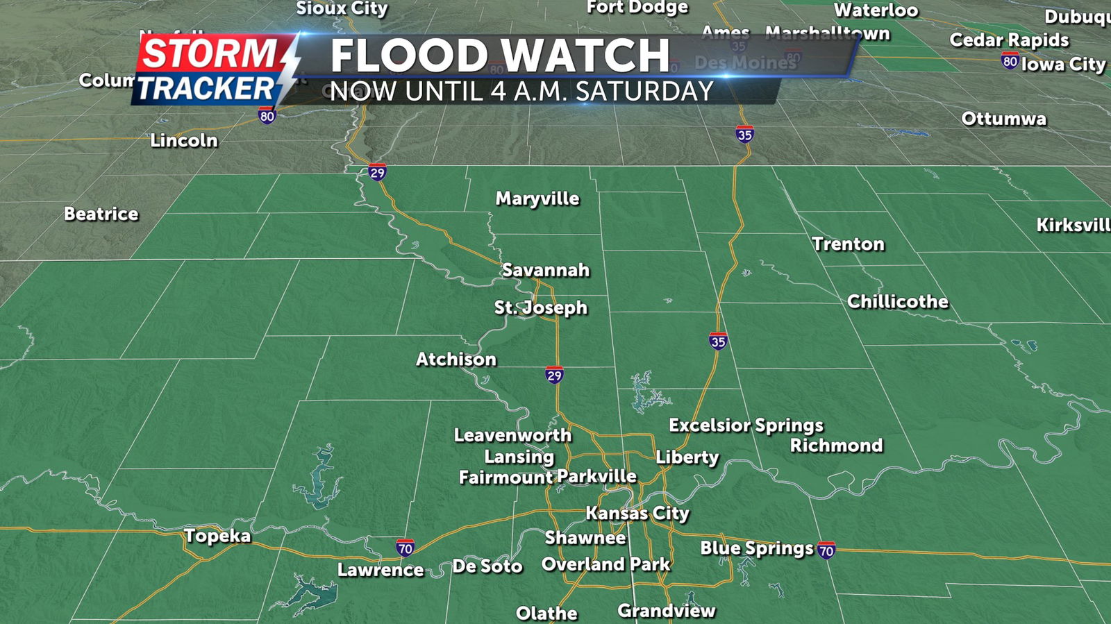
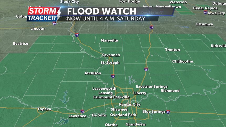
A Flood Watch remains in effect for all of northwest Missouri and northeast Kansas until 4 a.m. Saturday, July 26. Excessive runoff may result in flooding of rivers, creeks, streams, and other low-lying or flood-prone areas. Urban and poor drainage areas are also at risk.
Last night, most of the rain stayed south of Highway 36. Locally, rainfall totals are nearing 1.5 inches when combining yesterday’s storms with early morning showers. Additional rainfall of 1 to 5 inches is possible, which could lead to rapidly rising waterways and flash flooding.
On Saturday, a few lingering showers and thunderstorms are possible during the morning. Skies will begin to dry out by the afternoon with highs in the upper 80s. Sunshine returns Sunday, and highs will climb into the low 90s. That heat is expected to continue into next week.