Tracking lingering showers this morning, July heat, and possible late-week thunderstorms
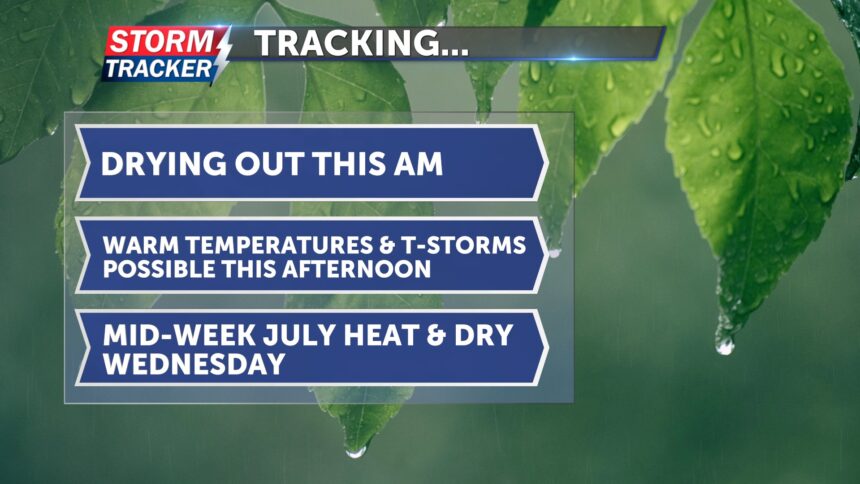
Rain this morning will linger before conditions become dry and mostly cloudy later in the day. Temperatures are starting off cooler but will climb into the mid-80s by this afternoon. Pop-up thunderstorms are possible later today if the atmosphere can recover. Showers and thunderstorms are trending farther south of Highway 36, more likely along the I-70 corridor. Tonight, skies will clear and temperatures will drop into the mid-60s.
Tomorrow, sunshine returns along with drier conditions. Winds will remain light. July heat makes a comeback with highs rising into the low 90s. Temperatures will cool to the upper 60s Wednesday night.
On Thursday, there is a slight chance of showers and thunderstorms. Some storms could become severe and may produce large hail and damaging winds, especially in far northwest Missouri.


