Tracking possible severe storms today: stormy, hot weekend ahead

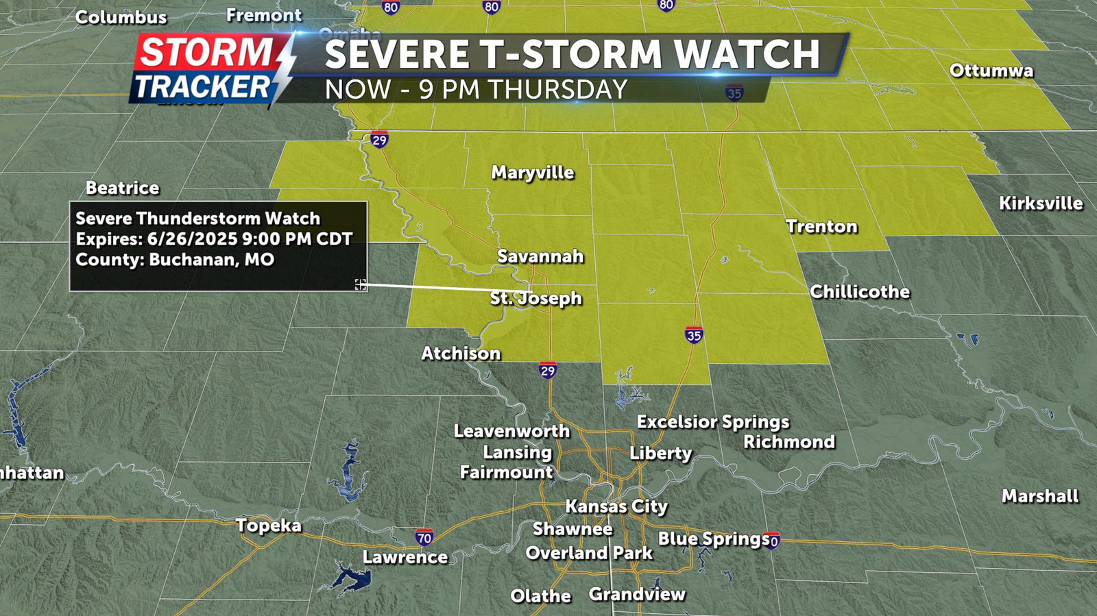
A Severe Thunderstorm Watch has been issued for parts of Northwest Missouri and Northeast Kansas through 9 p.m. on Thu. June 26. This includes Andrew, Atchison, Buchanan, Clinton Dekalb, Gentry, and Worth counties in Northwest Missouri, and Doniphan co. in Kansas.
This morning, skies are dry and will remain that way through lunchtime. Later this afternoon, there is a marginal risk for severe thunderstorms across northwest Missouri and northeast Kansas. As a cold front approaches this afternoon and evening, a few storms could develop along it — some of which may become severe. The primary hazards will be damaging winds and heavy rainfall, which could lead to localized flooding.
After the storms pass, skies will dry out again, and overnight lows will drop into the upper 60s. Tomorrow morning, expect a few more clouds. There is a slight chance for showers and thunderstorms in our area, but most of the activity is trending south of I-70.
This weekend will be hot and humid, with heat index values ranging from the mid-90s to upper 90s. There is also a slight chance for showers and thunderstorms both days. Afternoon highs will be in the low 90s, making for a hot and stormy weekend.
Update at 10:35 a.m., June 26, 2025:
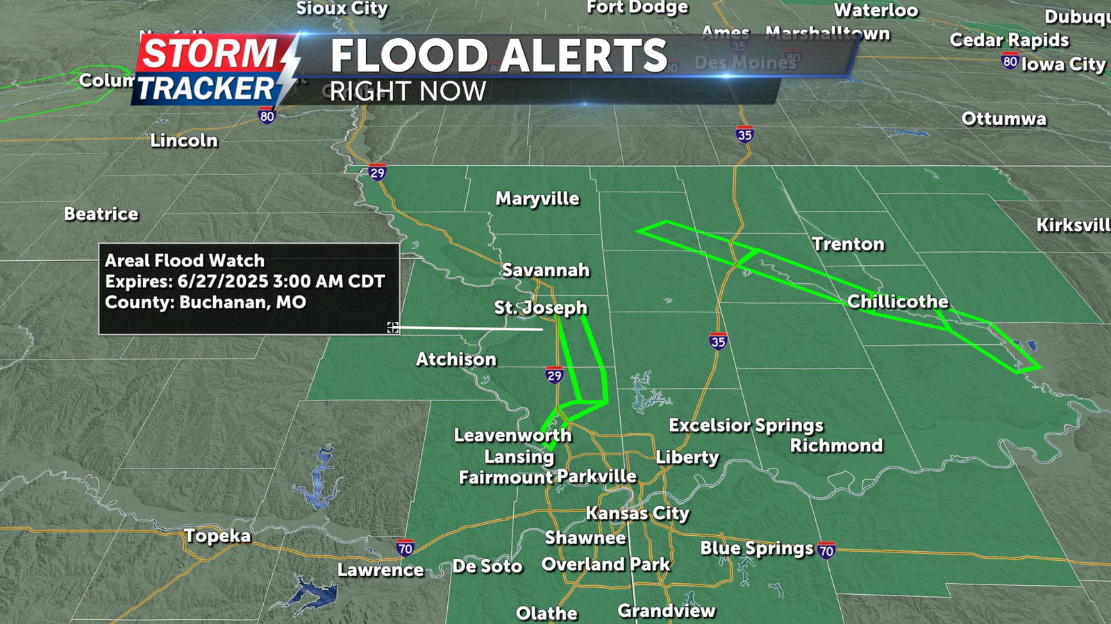
A flash flood watch has been issued for most of northwest Missouri and northeast Kansas, including the following counties: Atchison (Kan.), Doniphan (Kan.), Andrew, Atchison (Mo.), Buchanan, Clinton, Daviess, DeKalb, Gentry, Grundy, Holt, Mercer, Nodaway, Platte and Worth. The watch (in dark green) goes into effect at 5 p.m. this evening and remains in place until 3 a.m. Friday, June 27. It was issued due to excessive rainfall, which may lead to flooding of rivers, creeks, streams and other low-lying or flood-prone areas.
Flood warnings (light green) are still in effect across northwest Missouri due to heavy rainfall on Monday and Tuesday. There is still a flood warning for Buchannan and Platte County, as moderate flooding is occurring on the Platte River, as of today this warning does not expire until 7 am on Sunday, June 29, 2025.