Tracking multiple chances for showers and thunderstorms today
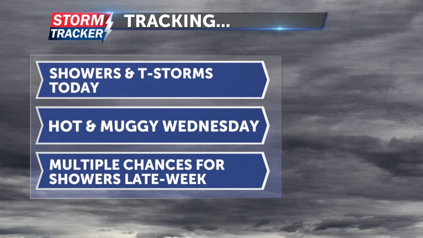
This morning, showers and thunderstorms have been moving northeast toward I-35. We will continue to see a chance for showers and thunderstorms before drying out briefly around lunchtime. During that dry period, cloud cover is expected. Despite the clouds, afternoon highs will reach the upper 80s, offering a little relief from the heat. Winds will be light today out of the south.
Later this evening, there is a chance for stronger thunderstorms in our area, with the potential to become severe. Damaging winds and heavy rainfall will be the primary threats. Tonight, temperatures will drop into the low 70s.
By tomorrow morning, it will be dry with a few clouds. Sunshine is expected throughout the day, with a few passing clouds. It will be hot and muggy, but the heat index won’t be as intense as it has been over the past few days. Winds will be breezy, sustaining between 5 and 10 mph, with gusts up to 18 mph.
Late this week and into the weekend, there will be multiple chances for showers and thunderstorms.
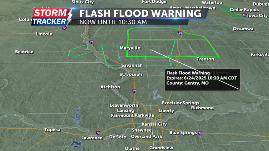
UPDATE: 8:30 AM 06/24/2025
Due to excessive rainfall, a flood advisory is in Andrew, Atchison, DeKalb, Gentry, Holt and Nodaway counties due to minor flooding in low-lying area and poor drainage areas. (area highlighted in slim green line)
A Flash Flood Warning has been issued for Grundy, Harrison, Mercer, Gentry, Nodaway, and Worth county until 10:30 AM. Between 2 an d 5 inches of rain have fallen, additional rain fall is expected in the warned area. Indicated by radar flash flooding is occurring in small creeks and stream, urban areas, highways, streets and underpasses as well as other poor drainage and low-lying areas. (area highlighted in thick green line)


