Tracking lingering heat and possible t-storms to the start of the work week
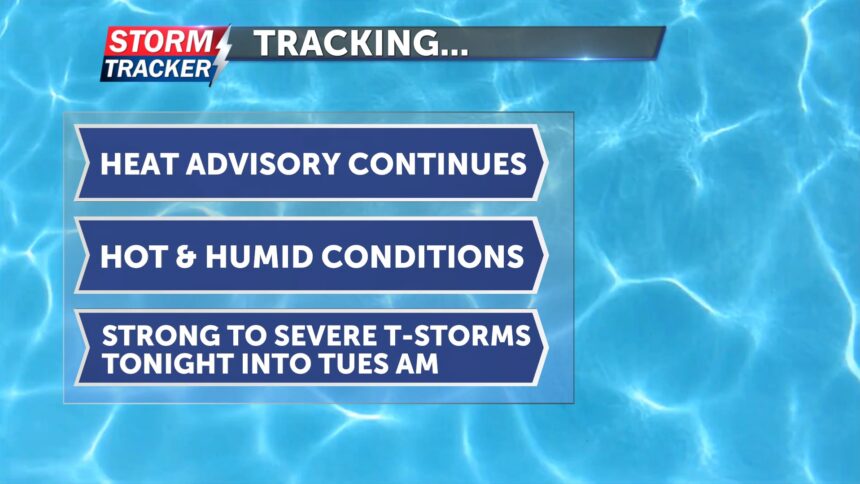
This morning hasn’t brought much relief from the heat, with temperatures starting off in the low 80s. Today will be another hot, humid, and windy day. A heat advisory remains in effect until 7 p.m., as heat indices are expected to climb above 100 degrees, with dew points in the upper 60s to low 70s. Afternoon highs will reach the mid-90s. Winds will stay gusty from the southwest, sustaining between 15 and 20 mph.
Later this evening and toward midnight, there is a chance for a few showers and thunderstorms. Some storms could become severe, with the potential for damaging winds and heavy rainfall that may lead to localized flooding. A few stronger storms are also expected in far northwest Missouri. Overnight lows will dip into the low 70s.
Tomorrow morning, a few lingering storms from overnight may persist. Another round of showers and thunderstorms is possible later in the evening and into Wednesday morning. Some of these storms could be severe, with threats of damaging winds and heavy rainfall.
Temperatures will remain in the 90s over the next few days.


