Chances just increased for a tropical storm during July 4th weekend
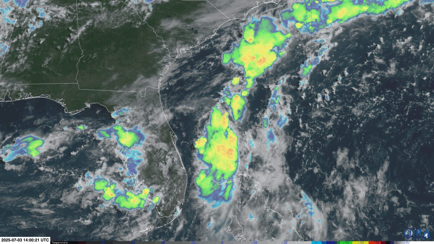
Stormy weather (indicated by the colored clouds) bubbles up near and over the Southeast on Thursday morning in the area the National Hurricane Center is keeping an eye on for tropical development.
By Briana Waxman, CNN
(CNN) — Repeated rounds of stormy weather loitering off the Southeast coast could do more than just dampen fireworks celebrations in Florida this weekend – there’s a good chance it becomes hurricane season’s next named storm.
On Friday, the National Hurricane Center increased the odds of a system forming this weekend or early next week to 70%. If this cluster strengthens into a storm, it would earn the next name on the Atlantic season’s list: Chantal.
Regardless of whether this system gets a name, it’s already delivering drenching rain, soaking the soil and raising the flood risk in Florida. The flood threat is especially concerning with millions of revelers set to enjoy outdoor parties and fireworks displays through the Independence Day weekend.
Portions of Florida and coastal Georgia could see flash flooding from this system through Friday, the Weather Prediction Center cautions. The threat shifts to the Carolina coast Saturday into Sunday as the storms could organize and move closer to land.
All told, rounds of storms could drop over 3 inches of rain on parts of the Carolina coast, while some areas in Florida could see up to 6 inches of rain by the end of the holiday weekend.
No name, no problem? Not necessarily
It doesn’t take a named tropical storm to cause trouble, particularly on a holiday weekend when roads and beaches could be packed.
Even without a well-defined center – which it needs to be considered a tropical system – this large area of stormy weather will drag rich tropical moisture across the coastal Southeast, leading to localized downpours, dreary beach days, a risk of dangerous rip currents and rough seas.
If it’s named, Chantal would be the third named storm of the season, but the first to pose an impactful flood threat to the United States just given its location. The first two systems, Andrea and Barry, were weak and short-lived tropical storms.
A third named storm at this time of year would not be unusual. Storms are more likely to form in the warm, shallow waters closer to land in July and, like the current system, spring up from fronts stalled out over juicy tropical air.
Fireworks, not floods, in the forecast beyond the Southeast
Outside of the Southeast, most of the country will see ideal conditions for July 4th weekend, particularly in the Northeast and West, where calm, mostly clear skies are expected from Friday on. The Southeast is likely to dry out by Tuesday.
The one exception: parts of the Plains and Upper Midwest, could see some strong to severe thunderstorms with damaging winds and hail through the weekend.
The-CNN-Wire
™ & © 2025 Cable News Network, Inc., a Warner Bros. Discovery Company. All rights reserved.


