Tropical Storm Melissa is expected to become a hurricane. Its track is unclear, but it’s bringing a dangerous threat
One forecast model shows Melissa dumping a dangerous amount of rain over portions of the Caribbean through the weekend.
By CNN Meteorologist Mary Gilbert
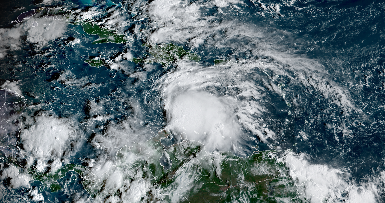
(CNN) — Tropical Storm Melissa has formed in the Caribbean Sea, proving this year’s Atlantic hurricane season won’t be wrapping up quietly.
The storm could slam the northern Caribbean with pouring rain and strong winds as it strengthens over extremely warm water this week. Melissa’s worst impacts could center on Hispaniola, where significant flooding and dangerous mudslides are possible for parts of the Dominican Republic and Haiti through the weekend.
Melissa was churning about 300 miles south of Haiti with maximum sustained winds of 50 mph as of late Tuesday morning, according to the National Hurricane Center.
The storm is expected to hit hurricane status by Saturday, according to the center, but it’s still tough to pin down exactly how strong it will become from there.
A hurricane watch has been issued for parts of Haiti and a tropical storm watch is in effect for Jamaica.
There’s a low, but non-zero chance Melissa directly impacts the mainland United States, though details are still coming into focus. Puerto Rico is much more likely to experience some of the storm’s rain.
Here’s what we know so far.
Days of rain and wind
Melissa’s exact track is still tricky to pin down, but there are two main scenarios forecasters have been monitoring for days. The one looking most likely at this point could spell disaster for parts of Hispaniola; the other could eventually take Melissa close to Central America.
Both involve Melissa first loitering out over the Caribbean Sea for multiple days this week, churning up seas and bringing nasty weather to islands within the storm’s reach.
From there, Melissa could take a turn to the north by late week and potentially move close to Hispaniola through the weekend, strengthening into a Category 1 hurricane by Saturday morning. This is the scenario the hurricane center’s track for the system reflects.
Melissa is the 13th named storm of the season but is the first to churn in the Caribbean Sea. The lack of storms allowed the Caribbean to become so extremely warm that its water is now basically rocket fuel for storms.
If Melissa taps into that energy, it could explode in strength – something that’s happening more often as the world warms due to fossil fuel pollution. Just this year, three of the four Atlantic hurricanes to date underwent extreme rapid intensification: Erin, Gabrielle and Humberto.
Melissa could bring more than a foot of rain to parts of Hispaniola. It’s still unclear exactly what parts of the Dominican Republic and Haiti would be subject to the heaviest rain, but the combination of torrential rain and mountainous terrain is a recipe for dangerous flash flooding and mudslides.
Melissa could also deliver a considerable amount of rain to Jamaica and Puerto Rico in this scenario, with flash flooding and mudslides possible.
Alternately, there’s still a chance that Melissa misses its window to take a northward turn and instead just creeps west over the Caribbean until it nears Central America — potentially Nicaragua or Honduras — next week. It could make landfall there or take a very late turn to the north and head for Cuba.
The northern Caribbean would likely still receive a few days of wet and windy weather in this scenario, but rainfall totals would be lower, as would the flood risk, with Melissa moving steadily west.
So… will it hit the US?
It’s unlikely — though not entirely impossible — Melissa will deliver a direct hit to the mainland US. At this time, the storm’s most likely impact to the US could be in the form of some rough surf and rip currents along the East Coast next week.
Florida could be in play if Melissa remains a weaker storm for longer and takes a turn to the north later than currently expected. In that case, Cuba and parts of the Bahamas could also be hit with Melissa’s wind and rain.
The odds of a hurricane landfall in the US really dwindle at the end of October and into November, but there have been notable late-season exceptions. Most recently, Hurricane Nicole slammed into Florida as a Category 1 in early November 2022 and Hurricane Zeta smashed into Louisiana as a Category 3 in late October 2020.
As Melissa continues to develop in the coming days, its track, strength and threats will come into sharper focus.
Atlantic hurricane season officially ends on November 30, though tropical systems can still form after that date.
The-CNN-Wire
™ & © 2025 Cable News Network, Inc., a Warner Bros. Discovery Company. All rights reserved.
CNN Meteorologist Chris Dolce contributed to this report.


