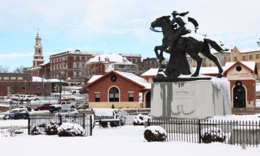
Most memorable weather events of 2025
The first week of 2026 is already behind us, but it’s not too late to reflect on last year’s wild weather highlights for Northwest Missouri and Northeast Kansas.
Continue Reading
The first week of 2026 is already behind us, but it’s not too late to reflect on last year’s wild weather highlights for Northwest Missouri and Northeast Kansas.
Continue Reading
The first month of meteorological winter started off with a bang in terms of cold and snowy weather across much of the Midwest, including here in the Mid-Missouri River Valley where at least an inch of snow was on the ground by Dec. 1, and in many spots several inches.
Continue Reading
Dec. 1 marked the start of meteorological winter just a few days ago.
Continue Reading
ST. JOSEPH, Mo. (KQTV) — The City of St. Joseph announced it has enacted Phase I of its snow ordinance, as snow continues to accumulate across the region. Phase I is declared during the first snowfall of the season and stays in effect through the end of winter. All-season/snow tires or chains are required on
Continue Reading
ST. JOSEPH, Mo. (News-Press NOW) — A blast of winter weather could bring multiple inches of snow and difficult driving conditions to St. Joseph and surrounding areas Monday.
Continue Reading
Below average temperatures are forecast for much of the United States through the final days of November and start of December based on the Climate Prediction Center’s 8 to 14 day outlook.
Continue Reading
A miraculous display of Aurora Borealis also known as the Northern Lights, took many by surprise earlier this week.
Continue Reading
Coldest air of the season so far expected across the Midwest Sunday and early Monday.
Continue Reading
Tracking above average temperatures and plenty of sunshine
Continue Reading
Tracking sunny days and a steady warm up
Continue Reading
Tracking freezing temperatures tonight: sunshine and milder temperatures ahead
Continue Reading
Cool and dry conditions continue across the Mid-Missouri River Valley for Halloween, with increasing clouds as a disturbance passes through the region. Temperatures fall from the 50s through the 40s after sunset, with light northwest breezes and lows bottoming out in the low 30s after midnight.
Continue Reading
ST. JOSEPH, Mo. (News-Press NOW) — Come Sunday, Nov. 2, clocks will fall back an hour, bringing daylight saving time to a close.
Continue Reading
Tracking Halloween chills and freezing temperatures
Continue Reading
After a foggy and chilly start to Thursday, sunshine has returned to the Mid-Missouri River Valley for the afternoon. Cool and clear conditions persist overnight, with temperatures dropping into the mid to low 30s, bringing another risk for frost early Friday morning.
Continue Reading
As October wraps up on a Friday, we also celebrate the spookiest holiday of the year, Halloween. Over the decades, Halloween has brought a wide range of weather to the St. Joseph area.
Continue Reading
Tracking a cool and potentially frosty Thursday morning
Continue Reading
Mostly cloudy and breezy conditions Wednesday afternoon will give way to clearing skies, light winds, and chilly temperatures overnight. Frost is possible across Northwest Missouri and Northeast Kansas early Thursday morning as temperatures near the freezing mark.
Continue Reading
Good morning, St. Joseph! We’re waking up to another cold and windy day across northwest Missouri and northeast Kansas. Temperatures are starting off in the mid-40s, but it feels much colder thanks to strong gusty winds blowing around the rain. Overnight, wind gusts reached up to 43 mph at the St. Joseph airport, and gusts
Continue Reading
ST. JOSEPH, Mo. (News-Press NOW) — Broadcast meteorologists, emergency management officials, MoDOT representatives and public health employees from Northwest Missouri and Northeast Kansas met to discuss ways to improve weather communication.
Continue Reading
Chilly rain and gusty winds will continue across the Mid-Missouri River Valley Tuesday night and early Wednesday morning, as a low-pressure system passes through the region.
Continue Reading
By JOHN MYERS JR. and DÁNICA COTO – Associated Press KINGSTON, Jamaica (AP) — Hurricane Melissa intensified Tuesday as it crawled toward Jamaica, where officials and residents braced for catastrophic winds, flash flooding and landslides from the Category 5 storm, one of the strongest Atlantic hurricanes in history. The streets in the capital, Kingston, remained largely
Continue Reading
Tracking a rainy & cool Tuesday
Continue Reading
Cloudy, cool, and damp conditions are widespread across Northwest Missouri and Northeast Kansas to start the work week, ahead of system expected to bring periods of additional rainfall back to the region Tuesday and Wednesday. Dry skies and sunshine eventually return later in the week, with slightly below average temperatures persisting through Halloween.
Continue Reading
ST. JOSEPH, Mo. (News-Press NOW) — Families are getting their costumes and baskets ready to hit the hot spots of St. Joseph for trick-or-treating on Halloween night.
Continue Reading
Tracking Monday drizzle & rain chances through Wednesday
Continue Reading
Tracking a cool and rainy start to the week
Continue Reading
Tracking drizzle and overcast skies tonight: scattered showers possible Sunday
Continue Reading
Overcast skies, cool temperatures, and patches of light rain Friday evening will largely persist this weekend, as a slow moving low pressure system tracks across the region.
Continue Reading
Tracking a gloomy and rainy weekend
Continue Reading