Tracking scattered severe t-storms Friday afternoon and evening
Scattered thunderstorms are popping across parts of Northwest Missouri and Northeast Kansas early Friday afternoon. Storms are forecast to increase in coverage, and pose a risk for damaging winds, hail, and localized pockets of heavy rainfall. A low-end risk for a tornado or two also exists, mainly across southern Iowa. Although a brief spin up cannot be ruled out across far Northern Missouri.
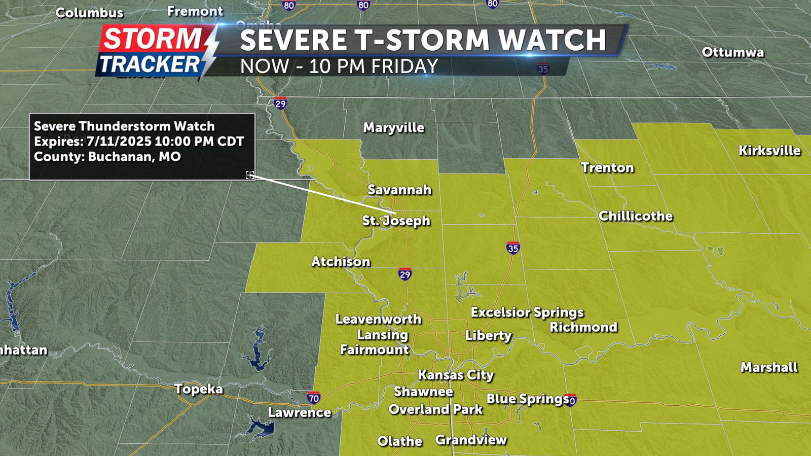
A Severe Thunderstorm Watch has been issued for much of Northwest Missouri and Northeast Kansas through 10 p.m. Friday. Northeast Kansas counties: Atchison, Doniphan, Leavenworth, Wyandotte. Northwest Missouri Counties: Andrew, Buchanan, Clinton, Dekalb, Holt, Platte. West Central Missouri Counties: Cass, Clay, Jackson, Johnson, Lafayette, Ray.
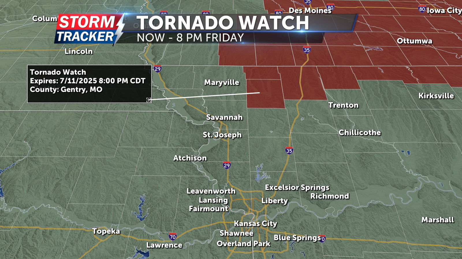
A Tornado Watch remains in effect for Worth and Gentry counties in Northwest Missouri through 8 p.m. Friday.


