Tracking summer heat and sunshine this weekend

Happy Friday and first day of summer St. Joseph! This morning, a stray thunderstorm passed to our northeast, leaving St. Joseph proper dry. As the sun rises, it will give way to sunshine for the rest of the day.
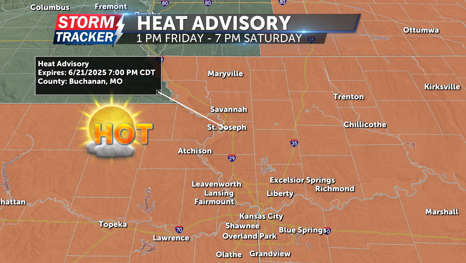
A heat advisory is in effect from 1 p.m. today through 7 p.m. Saturday. Heat index values are expected to reach between 100 and 106 degrees both this afternoon and Saturday afternoon, increasing the risk of heat-related illness. It will also be windy, with southwesterly winds sustained at 15 to 20 mph and gusts up to 30 mph. Tonight, skies will remain clear with overnight lows in the upper 70s. Breezy southerly winds will continue.
Saturday will bring a repeat of today—hot, humid and windy. Temperatures will again reach the mid-90s, with heat index values between 100 and 105 degrees. The heat advisory remains in effect until 7 p.m. Sunday will stay sunny and windy, but slightly less humid. Heat indices will range from 95 to 103 degrees.
Multiple chances for rain and thunderstorms return early next week.