Fall-like weather is coming. Will it last?
Temperatures will drop in the wake of a cold front over the coming days.
By CNN Meteorologist Mary Gilbert, CNN
(CNN) — A blast of fall-like weather is coming for much of the United States, and unlike the last brief break from summer heat, this cooldown will have some staying power.
It will feel more like late September or early October as crisp air expands in the coming days, but it remains to be seen if this is just an autumnal test run or if the refreshing weather is here to stay.
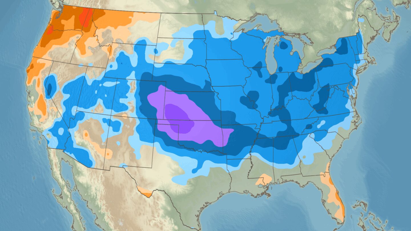
The cooldown kicks off with a cold front that’s moving through the north-central US on Friday. That cold front will dive farther south and east through the weekend and early next week, ushering in a rush of cool air from Canada. An extra push or two of this fall-like air could follow behind the initial blast later next week, prolonging its reign.
The Dakotas will be the first to feel the September-like cooldown. High temperatures in Bismarck, North Dakota, will barely reach the low 70s on Saturday and Sunday, which is about 10 degrees below normal for this time of year.
Minneapolis will also get in on the unseasonable coolness. Saturday morning’s low temperature is forecast to dip into the upper 50s, which would be the first time all month the city has gotten below 60 degrees. Sunday’s high of 67 degrees will likely be the lowest of this stretch – and the city’s coolest since late June.
The autumnal air expands into more of the Midwest and Plains to start next week.
Chicago will only top out at around 70 degrees on Monday, which is about 10 degrees below normal and is the coolest high in the city since June 1. The September-like 70s will remain for much of the week with overnight lows in the mid-50s.
Monday and Tuesday will be the coolest days of the week in Kansas City, Missouri, with highs in the mid-70s expected. But it’s the overnight lows in the mid-50s that will be the biggest difference: The city hasn’t seen a night that cool since early June.
Oklahoma City will feel more like mid-October than late August by Tuesday with an expected high in the low 70s, about 15 degrees cooler than normal. A high that cool was last felt in the city in late May.
Wednesday is when the cooldown should hit its maximum reach, with cooler than normal conditions breezing through much of the South, all the way to the Gulf Coast.
Dallas could top out in the upper 80s on Wednesday, which is only about 5 degrees lower than average. That may not sound all that cool, but Dallas hasn’t had a high temperature below 90 degrees since early July. By the time Wednesday rolls around, the city will have had seven weeks with temperatures over 90 degrees — one of the 15 longest stretches there in the last 50 years.
Some of the West will finally get relief from a punishing heat dome by midweek. Wednesday’s high temperature in Phoenix could be in the mid-90s, which would be the first non triple-digit high since July. Farther north, Salt Lake City could have highs in the low 70s – 15 degrees cooler than normal – on Wednesday and Thursday.
What about the East?
Parts of the Northeast and mid-Atlantic — Boston, New York City and Washington, DC, included — have already been enjoying pumpkin-spice weather this week, thanks to an earlier cold front and a wind shift from Hurricane Erin that funneled in chilly air.
Much of the region will actually see a brief warm up this weekend before cool temperatures make a comeback. Next week will once again be cooler than normal, with temperatures slightly higher than the deep autumnal chill of the past few days.
Still, that means widespread highs in the 70s will stretch from Virginia to Ohio and all the way to the Canadian border by Tuesday. Some higher elevation areas of the Appalachians may only get to the 60s or even stay stuck in the 50s.
That September-like chill will persist Wednesday before temperatures creep up a few more degrees, but still remain a bit cooler than normal on Thursday.
Another push of cooler air from Canada is possible late next week, which could keep this taste of autumn around through at least Labor Day weekend.
Summer might not go down without a fight
While autumn lovers rejoice, the threat of warmer than normal weather is always on the horizon.
Forecasts from the Climate Prediction Center indicate cooler than normal conditions will stick around into at least early September, but the center’s forecast for the upcoming month as a whole paints a different picture.
September is expected to end up warmer than average for the Lower 48, the center’s forecasts show, with meteorological fall itself – September through November – also set to be warmer than normal for most of the country.
The-CNN-Wire
™ & © 2025 Cable News Network, Inc., a Warner Bros. Discovery Company. All rights reserved.
CNN Meteorologist Briana Waxman contributed to this report.


