Trump admin will cut hurricane forecasters out of key satellite data in one month
By Andrew Freedman, CNN
(CNN) — The abrupt cutoff of satellite data crucial for hurricane forecasting is delayed by one month, until July 31, according to a message posted by the National Oceanic and Atmospheric Administration Monday.
The impending data loss from a Department of Defense weather satellite system was announced on June 25 and slated to take place “no later than” Monday, according to an earlier NOAA announcement.
The Defense Department will still maintain the Defense Meteorological Satellite program, but announced last week it would cease sharing the imagery with NOAA and NASA.
The decision, which was initiated by the Defense Department, caused an uproar among meteorologists, public officials and the media in the midst of hurricane season. The fear is that the missing information could degrade the accuracy of hurricane forecasts. The move comes in the wake of steep personnel cuts at the National Weather Service and other parts of NOAA.
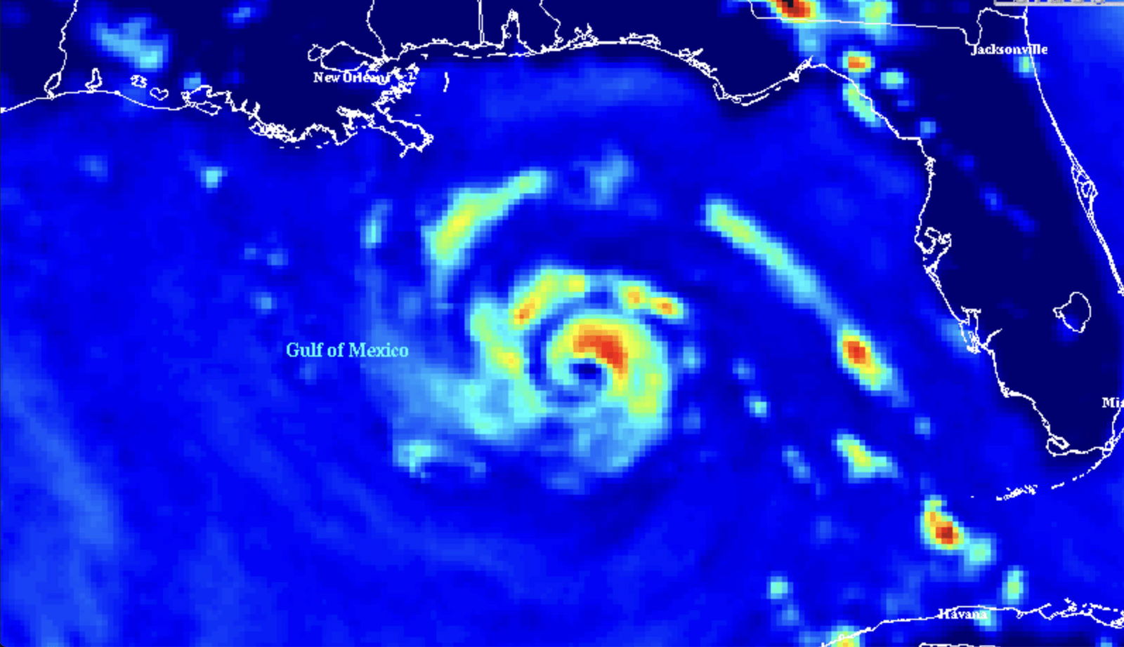
The data in question is from a microwave sounder data known as the Special Sensor Microwave Imager Sounder, or SSMIS. This tool is like a 3D X-ray of tropical storms and hurricanes, revealing where the strongest rain bands and winds are likely to be and how they are shifting.
Such imagery provides forecasters with information about a storm’s inner structure and is one of the limited ways they can discern how quickly and significantly a storm’s intensity is changing, particularly at night and during periods when hurricane hunter aircraft are not flying in the storm.
According to a former NOAA employee familiar with the matter, the Defense Department’s actions caught the nation’s weather and oceans agency off guard, along with NASA, whose scientists also use this satellite imagery.
A current NOAA staff member also told CNN the agency, including the National Hurricane Center, was blindsided by the sudden data cut off when it was first announced.
The delay through July, both sources said, is the result of pressure from NOAA and NASA officials. The new NOAA message supports this, stating: “Late on Friday, June 27th, CNMOC received a request from Dr. Germain with NASA to postpone the removal and to continue processing and distributing DMSP data through July 31st.”
“An update service advisory will be sent and FNMOC now expects to decommission DMSP processing no later than July 31st,” the message states, referring to the Navy’s Fleet Numerical Meteorology and Oceanography Center. The satellite status message references Karen M. St. Germain, the division director for NASA’s Earth Science Division. This indicates the intervening of a high level official in this matter.
The one month delay does not solve the issue since hurricane season peaks in August and September, and there currently is no plan in place for resuming the flow of this data, even when a new Defense Department weather satellite begins operations in October. Currently, NOAA is planning for that microwave imagery from that satellite will flow to the agency.
According to media reports last week, the Defense Department’s rationale for cutting off this data has to do with cybersecurity concerns stemming from the way the data is transmitted between agencies.
NOAA has publicly maintained there are many other sources of data on hurricanes that will allow for accurate forecasts this season.
The Atlantic hurricane season does not end until November 30, and this season is expected to be another unusually active one.
This is a developing story and will be updated.
The-CNN-Wire
™ & © 2025 Cable News Network, Inc., a Warner Bros. Discovery Company. All rights reserved.


