A potent heat dome is building over the US, sending temperatures into the triple digits
The first of two rounds of extreme heat is underway for parts of the eastern half of the United States
By Tyler Ory, CNN
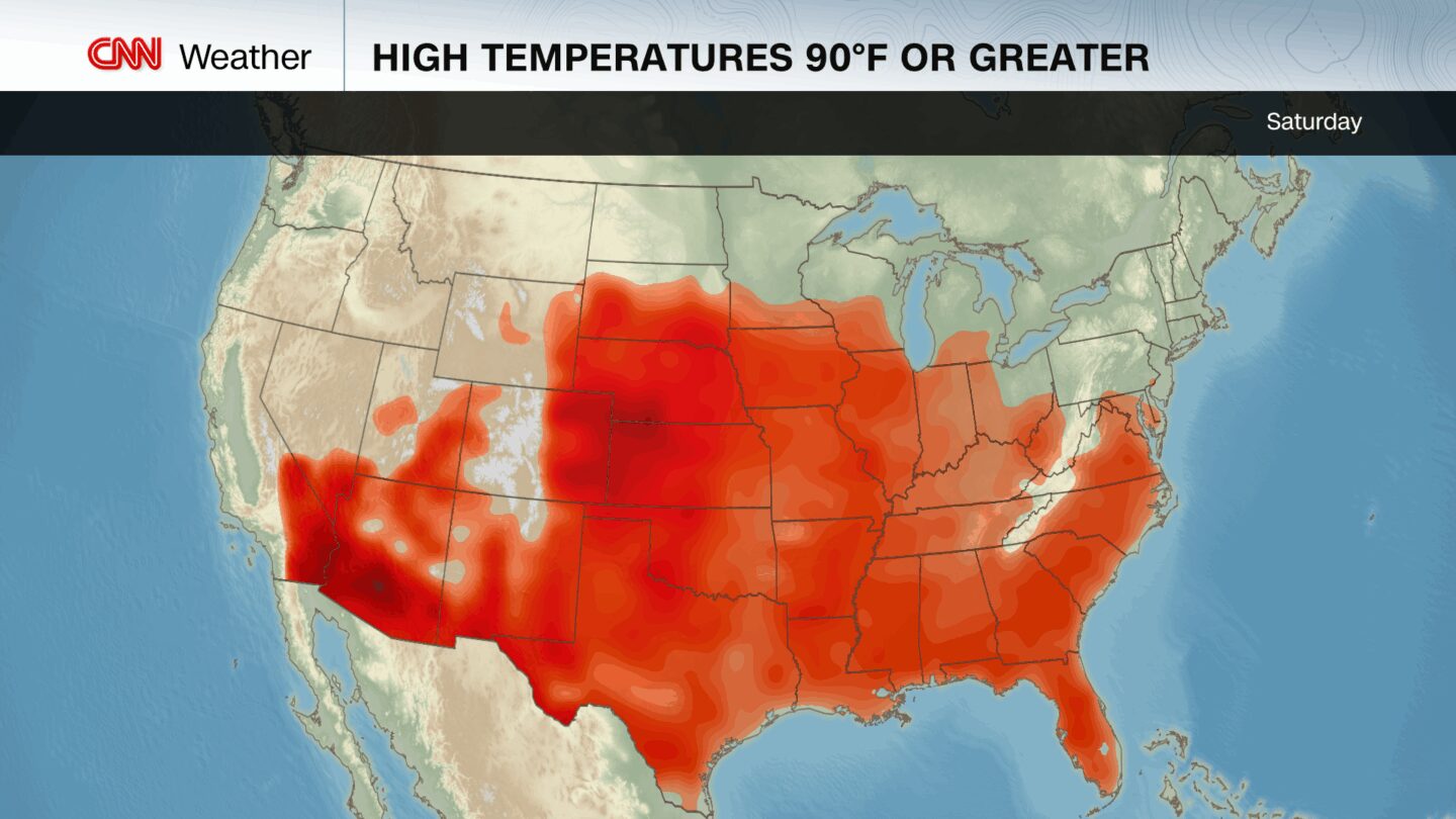
(CNN) — The hottest temperatures of the year so far will soon reach the eastern half of the United States as a brutal heat dome starts to build over the weekend. Dangerous, record-breaking heat will impact millions next week.
Much of the East is getting a brief respite from the July-like heat that baked the region earlier this week, but thermometers will soar to even more extreme levels starting Sunday.
Tens of millions of people from the Midwest to the East Coast will face a level 4-of-4 extreme heat risk Sunday through at least Thursday, according to the National Weather Service. Such long-lasting heat is rare, will likely offer little to no overnight relief and will affect anyone without effective cooling and/or adequate hydration,” the agency warns.
High temperatures across the Plains, Midwest, Mid-Atlantic and Northeast are expected to hit at least 15 degrees above normal next week and will mark the hottest temperatures of the year to date, rising well into the 90s. With humidity, it could feel as hot as 110 degrees — especially in the Mid-Atlantic.
The heat will peak in the Northeast and Mid-Atlantic early next week. Forecast highs are around 97 degrees in New York City Sunday through Tuesday and could break daily records. In Washington, DC, the temperature could reach 100 — matching or breaking records on both days. Boston is expected to be around 90 degrees on Monday and 94 on Tuesday, just shy of daily records set in the mid-90s.
Over 250 daily temperature records could be broken on Monday and Tuesday, including both record highs and record warm lows — many at sites with data going back to the early 1900s.
Heat remains the deadliest form of extreme weather in the US, contributing to more than 800 deaths annually on average since 1999, a 2023 study found.
Days of intense heat disproportionately drive more severe public health impacts, even in places accustomed to summer heat. Emergency room visits for heat-related illness surge on “major” and “extreme” risk days, particularly when high humidity and warm nights prevent the body from cooling, according to the National Weather Service.
Nighttime temperatures are also warming faster than daytime highs due to climate change. This makes it harder for the body to cool and recover and increases the risk of heat-related illness and death.
This stretch of heat is building just as the seasons officially change. The summer solstice was on Friday at 10:42 p.m. ET, the moment the Northern Hemisphere is tilted closest to the sun. The solstice brings the highest sun angles and longest days of the year, meaning more solar energy is available to fuel extreme heat.
The solstice is the start of astronomical summer, but meteorologists mark the beginning of summer on June 1, using calendar months to better match seasonal weather patterns.
The hottest weeks of the year still lie ahead. For nearly all of the country — outside of parts of the Desert Southwest in Arizona, New Mexico and West Texas — the warmest days typically occur in July or August.
This early-season event is likely just a preview of what’s to come, though this stretch of heat is expected to ease by the end of next week.
The-CNN-Wire
™ & © 2025 Cable News Network, Inc., a Warner Bros. Discovery Company. All rights reserved.
CNN Meteorologist Mary Gilbert contributed to this report.